R. V. Tooley
1898 – 1986
Books
- My head is a map
- Collecting antique maps
- English books with coloured plates, 1790-1860
- The mapping of Australia and Antarctica
- Printed sea charts of Scandinavia
- Printed maps of America
- Printed maps of St. Kitts, St. Lucia and St. Vincent
- A sequence of maps of America
- Title pages
- Geographical oddities, or, Curious, ingenious, and imaginary maps and miscellaneous plates published in atlases
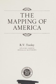
- The Mapping of America
- Maps and map-makers
- English books with coloured plates, 1790 to 1860
- A dictionary of mapmakers
- French mapping of the Americas
- The printed maps of New South Wales 1773-1873
- Tooley's handbook for map collectors
- Early maps and views of the Cape of Good Hope
- Printed maps of Australia
- A sequence of maps of Africa
- Some portraits of geographers
- Printed maps of America
- A dictionary of mapmakers, including cartographers, geographers, publishers, engravers, etc., from earliest times to 1900
- Los Belgicus
- The mapping of Australia
- One hundred foreign maps of Australia, 1773-1887
- Printed maps of southern Africa and its parts
- Title pages from 16th to 19th century
- Collectors' guide to maps of the African continent and southern Africa
- Early Antarctica
- Leo Belgicus
- Maps in Italian atlases of the sixteenth century, being a comparative list of the Italian mapsissued by Lafreri, Forlani, Duchetti, Bertelli and others, found in atlases
- The printed maps of Antigua, 1689-1899
- The printed maps of Dominica and Grenada
- Printed maps of Tasmania, 1642-1900
- California as an island
- Early maps of Australia
- Geographical oddities
- The printed maps of Tasmania
- Some portraits of geographers and other persons associated with maps

Author data: Open Library