Ordnance Survey
Books
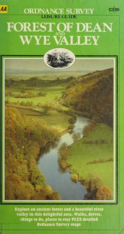
- Forest of Dean and Wye Valley
- Oban and East Mull
- Walk London
- Britain on Backroads
- North West Norfolk, King's Lynn and Fakenham
- Skegness and Horncastle
- Blackpool and Preston
- Grimsby, Cleethorpes and Immingham, Caistor and North Thoresby
- Cambridge, Royston, Duxford & Linton
- Telford, Ironbridge and the Wrekin (OS Explorer Map)
- EXP 259 Derby Uttoxeter Ashbourne Cheadl (EXPLORER MAP)
- North East Norfolk, Cromer and Wroxham (OS Landranger Map)
- South Hampshire
- Weston-super-Mare, Bridgwater and Wells
- Louth and Mablethorpe
- Wolverhampton and Dudley, Stourbridge and Kidderminster (OS Explorer Map)
- Bedford and St.Neots, Sandy and Biggleswade (OS Explorer Map)
- Chiltern Hills West, Henley-on-Thames and Wallingford (OS Explorer Map)
- Nottingham, Vale of Belvoir (OS Explorer Map)
- Badenoch & Upper Strathspey, Kingussie & Newtonmore
- Elan Valley & Builth Wells
- Stafford and Telford, Ironbridge
- Lincolnshire Wolds North
- Bolton, Wigan and Warrington
- Rhondda and Merthyr Tydfil (OS Explorer Map)
- Southend-on-Sea & Basildon (Explorer Maps)
- Okehampton and North Dartmoor
- Aberystwyth and Machynlleth
- Peterborough, Market Deeping and Chatteris
- Snowdon
- West Pennine Moors - Blackburn, Darwen and Accrington
- Isles of Scilly (OS Explorer Map)
- Thornbury, Dursley and Yate (OS Explorer Map)
- Perth and Kinross (OS Explorer Map)
- Cambridge (Explorer Maps) 209 (OS Explorer Map)
- Boston and Spalding
- Brecon Beacons (OS Landranger Map Active)
- Southport and Chorley
- Bury St.Edmunds and Stowmarket (OS Explorer Map)
- Loch Laggan & Creag Meagaidh, Corrieyairack Pass

Author data: Open Library