John Bartholomew
1831 – 1893
Books
- Philips' 19th century county atlas of Ireland
- North Wales (part 1)
- Zell's descriptive hand atlas of the world
- The pocket atlas of the world
- Philip's new map of Middlesex with portions of the adjoining counties from the Ordnance Survey
- Atlas of the world
- Philip's handy atlas of the counties of Ireland
- The student's atlas...
- Philips' handy atlas of the counties of Ireland
- Gazeteer of the British Isles, statistical and topographical
- The advanced atlas
- The library reference atlas of the world
- Handy reference atlas of the world
- Handy reference atlas of the world
- Atlas of the world
- The portable atlas...
- The citizen's atlas of the world
- The English lake district
- The elements of conveyancing
- Pocket atlas of England & Wales
- The British colonial pocket atlas
- Philip's handy atlas of the counties of Ireland
- The British colonial pocket atlas
- Philips' handy atlas of the counties of Scotland
- Philip's handy atlas of the counties of Scotland
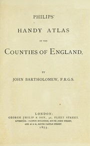
- Philips' Handy Atlas of the Counties of England
- Pocket guide to Edinburgh and neighbourhood
- Gazetteer of the British Isles
- Zell's descriptive hand atlas of the world
- Philips' atlas of the counties of England, reduced from the ordnance survey
- Black's school atlas for beginners
- Pocket atlas of Ireland
- The student's atlas, consisting of thirty-two maps of modern geography, embracing all the latest discoveries and changes in boundaries, and six maps of ancient and historical geography
- The student's atlas, consisting of forty-four maps of modern geography, [embracing all the latest discoveries and changes in boundaries;]
- Pocket atlas of Scotland
- Elementary school atlas

Author data: Open Library