Great Britain. Ordnance Survey
Books
- Gazetteer of Great Britain
- Cheshire
- Sheet 31/76
- A description of the large scale maps of Great Britain produced and published by the Ordnance Survey
- Letters containing information relative to the antiquities of the County of Longford, collected during the progress of the Ordnance survey in 1838
- Catalogue of the 6-inch and 25-inch county maps and town plans of England, Wales, and the Isle of Man, and of the 1-inch and smaller scale maps, and other publications of the survey
- Letters containing information relative to the antiquities of the county of Galway, collected during the progress of the Ordnance survey in 1839
- Letters containing information relative to the antiquities of the county of Waterford, collected during the progress of the Ordnance survey in 1841
- Report of the progress of the Ordnance Survey for the financial year 1st April, 1934 to 31st March, 1935
- Roman Britain
- Letters containing information relative to the antiquities of the county of Limerick
- Letters containing information relative to the antiquities of the County of Tipperary
- Price list of Ordnance Survey publications
- Ordnance Survey Road Atlas of Great Britain
- Map of Neolithic Wessex showing the distribution of long barrows, circles, habitation sites, flint mimes ...
- Ordnance Survey, [Grosvenor Square, London, and vicinity]
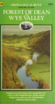
- Forest of Dean and Wye Valley
- Ordnance trigonometrical survey of Great Britain and Ireland
- Catalogue of the maps and plans and other publications of the Ordnance Survey of England and Wales and the Isle of Man, to 1st January 1881
- Letters containing information relative to the antiquities of the Queen's County, collected during the progress of the Ordnance Survey in 1838
- Ordnance survey of the county of Londonderry
- Map of Britain in the Dark Ages
- Letters containing information relative to the antiquities of the county of Sligo, collected during the progress of the Ordnance survey in 1836
- Old Series Ordnance Survey Maps of England and Wales, Scale : 1 Inch to 1 Mile
- [Domesday book, or, The great survey of England of William the Conqueror A.D. MLXXXVI]
- Abstracts of the principal lines of spirit levelling in England and Wales
- Domesday book, or, The great survey of England of William the Conqueror A.D. MLXXXVI
- Letters containing information relative to the antiquities of the county of Dublin, collected during the progress of the Ordnance survey in 1837
- Catalogue of the maps and plans and other publications of the Ordnance Survey of Scotland to 1st Feb. 1884
- Catalogue of the maps and plans and other publications of the Ordnance Survey of England and Wales, and the Isle of Man, to 1st Jan. 1895
- Ordnance survey motoring atlas
- Letters containing information relative to the antiquities of the County of Wexford, collected during the progress of the Ordnance Survey in 1840
- Domesday book, or, The great survey of England of William the Conqueror A.D. MLXXXVI
- Ordnance Survey road atlas of Great Britain
- Letters containing information relative to the antiquities of the county of Carlow
- Extension of the triangulation of the Ordnance survey into France and Belgium ...
- Catalogue of the maps and plans and other publications of the Ordnance survey of Ireland to 18th Sept. 1882
- Letters containing information relative to the antiquities of the county of Meath, collected during the progress of the Ordnance survey in 1836
- Map of Southern Britain in the Iron Age
- County street atlas Herts
- Domesday Book



Author data: Open Library